
The wall cloud, rotating and not
The feature spotters are most often looking for, its definition in full, and the three signals that decide whether it is worth a radio call.
The definition, in full
Four things in that paragraph do real work. Localized and persistent rule out the ragged lowering that appears for thirty seconds and dissolves. Inflow side places it: south or south-west, on the rear flank, under the updraft base, not out front on the The leading edge of cool air rushing out of a storm, ahead of the rain. It is what makes the wind pick up sharply just before a storm arrives.. Not all wall clouds rotate is the sentence most summaries drop. And a few minutes up to nearly an hour is the How long between a warning being issued and the severe weather arriving. Quoted two ways: counting only the warnings that beat the event, or averaging in the events nobody warned at all, which roughly halves it. you may be working with.
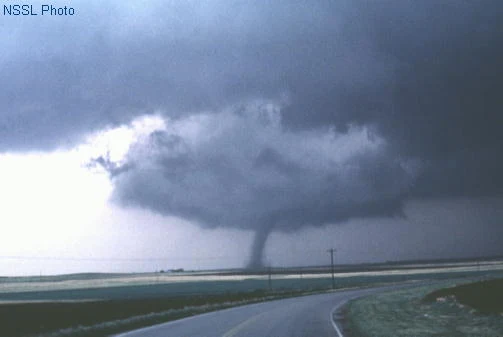
What makes it reportable
A wall cloud is a feature. A rotating wall cloud is a report. Three signals, and you want more than one:
- Sustained rotation. Not one apparent turn. Persistent, in one direction, over a watching period. Lesson 7 is the technique for establishing this honestly.
- Rapid vertical motion. Cloud material visibly ripping upward into the base, often fastest where the A horizontal cloud reaching from the rain area toward the wall cloud, at about wall-cloud height, with its material moving toward the wall cloud. joins.
- Persistence. It is still there, and still doing both of the above, minutes later.
How often does a wall cloud become a tornado?
Nobody knows, and this course is not going to tell you. There is no defensible peer-reviewed conversion rate, and a precise-sounding percentage here is one of the things this material is specifically audited to keep out. What can be said is qualitative and comes from National Severe Storms LaboratoryA research laboratory, not an operational office. It develops the techniques forecasters use, but issues no products and takes no reports.: a wall cloud can exist for ten to twenty minutes before a tornado appears, but not always.
If you meet a figure for this in a class or a forum, ask what it cites. The honest answer is that most wall clouds do not produce tornadoes and the fraction that do has never been pinned down in a way that survives review.
The tail cloud
The motion is the identification. Cloud material moving out of the rain and into the lowering, accelerating upward where they meet, is rain-cooled air being ingested by the The column of rising air inside a storm. Everything a thunderstorm does, from hail to tornadoes, is downstream of how strong and how organised this is.. That is also, in one sentence, how a wall cloud forms.
You watch a localized lowering under the updraft base for three minutes. It persists, but shows no rotation and no obvious vertical motion. What do you report?
The definition says something explicit about whether wall clouds rotate.SR-145 says plainly that "not all wall clouds rotate", so a wall cloud is not a rotation report on its own. Describe what you saw and what you did not: a persistent wall cloud, no rotation observed. That is a useful thing for an office to hear, and it is honest. Keep watching, because this can change in minutes.